GPS Map Camera - Timestamp
Sliver AI Photo EditorRating0

Installs
5M+
Developer
Sliver AI Photo Editor
Category
Productivity
Content Rating
Everyone
Developer Email
mega.china2050@gmail.com
Privacy Policy
https://docs.google.com/document/d/e/2PACX-1vQ7Y9FW4r7ixX1mzXahMPH2gEliZwbNP9lmCBaryzyflmmX83TJ96Q8h7VOcuhPtFSOe4g0RuXxk8-l/pub
Screenshots


About this app
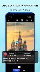
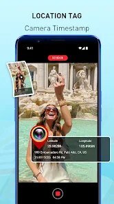
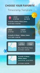
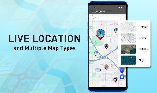
GPS Map Camera - Timestamp by Sliver AI Photo Editor is a productivity app that stamps photos with location and time data at the moment you shoot. As you take a picture, it overlays details such as GPS coordinates, a small map thumbnail, address or place name, date, time, and sometimes weather or custom notes directly onto the image. It is built for field work and documentation: construction and site inspections, real estate, delivery and service proof, surveying, insurance records, and anyone who needs verifiable on photo evidence of where and when a shot was captured. By embedding context into the photo itself, the app turns ordinary pictures into self contained records that are easy to file, share, and reference later without separate logs.
Expert Review
GPS Map Camera - Timestamp targets a genuinely practical need, and for field documentation it is a capable tool. Stamping coordinates, a map snippet, address, and time directly onto each photo removes the friction of keeping separate notes, which is valuable for inspections, real estate, and proof of service. From an informed standpoint, its usefulness depends on the quality of your device GPS and a clear signal; indoors or in dense areas the location can drift, so the embedded data is only as accurate as the underlying positioning. Customization of the stamp layout and fields is a strong point, while the honest considerations are the permission footprint, since it needs camera and precise location, and the advertising or premium tiers common to this category that may gate certain templates. For professionals who need quick, contextual photo records and who verify signal quality before relying on the data, it is a sensible, time saving choice.
Key Functional Highlights
- Stamps GPS coordinates and address on photos
- Adds date, time, and a small map thumbnail
- Optional weather, notes, and custom fields
- Customizable stamp layout and information shown
- Saves geotagged images ready to file or share
Advantages & Benefits
- Creates self contained, verifiable photo records
- Saves time by removing separate location logs
- Ideal for inspections, real estate, and field proof
- Easy to share documented photos with teams or clients
- Keeps where and when context attached to every shot
More Apps
-

ESPN
Disney4.3
-

FOX Sports: Watch Live Games
Fox Digital Services, LLC3.7
-

Subway®
SUBWAY Restaurants4.2 -

Zoom - One Platform to Connect
zoom.us4.1 -

Amazon Shopping
Amazon Mobile LLC4.1 -

Sam's Club: Shopping & Savings
Sam's Club4.8 -

WhatsApp Messenger
WhatsApp LLC4.5 -

Telegram
Telegram FZ-LLC4.2 -

PayPal - Send, Shop, Manage
PayPal Mobile4.3